

Seaware Routing 6.1
Seaware Routing provides advanced route planning with graphical weather presentation
Program info
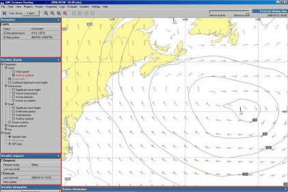
Seaware Routing is a powerful feature of the Seaware Onboard product line that allows users to plan routes based on graphical weather presentation. Subscriptions to new weather forecasts can be set up with customizable resolution, area and time range, allowing users to predict the ship's speed reduction, fuel consumption and estimated time of arrival. Different route alternatives can be compared graphically on the chart.
Seaware Routing is the backbone of the Seaware Onboard product line owing to its fundamental, yet rich, set of features. Based on graphical weather presentation, many advanced route planning tasks may be accomplished. New weather forecasts may be subscribed to for delivery at desired intervals, with selectable resolution, area and time range. Based on the weather forecasts, the ship's speed reduction, fuel consumption and ETA along an intended route may be predicted. Several different route alternatives may be evaluated for comparison side-by-side, either graphically on the chart or numerically in various tables. An even more powerful tool is the route optimization, by which a route can be optimized considering user-defined constraints such as lowest total cost or avoiding bad weather.
Details
Extensions

No information available
The data will be available later.Awards

There are no awards
Over time, app awards will appear here.


Comments